


Originally published in Maven’s Notebook.
A proposed restoration project at the southern end of the Yolo Bypass will connect existing wetlands while supporting agriculture and flood management. At the Delta Stewardship Council’s September meeting, Judah Grossman of the Department of Water Resources’ Division of Multi-Benefit Initiatives briefed council members on the ecological, flood-conveyance, and land-use benefits of the 2,212-acre Tide’s End Multi-Benefit Restoration Project.
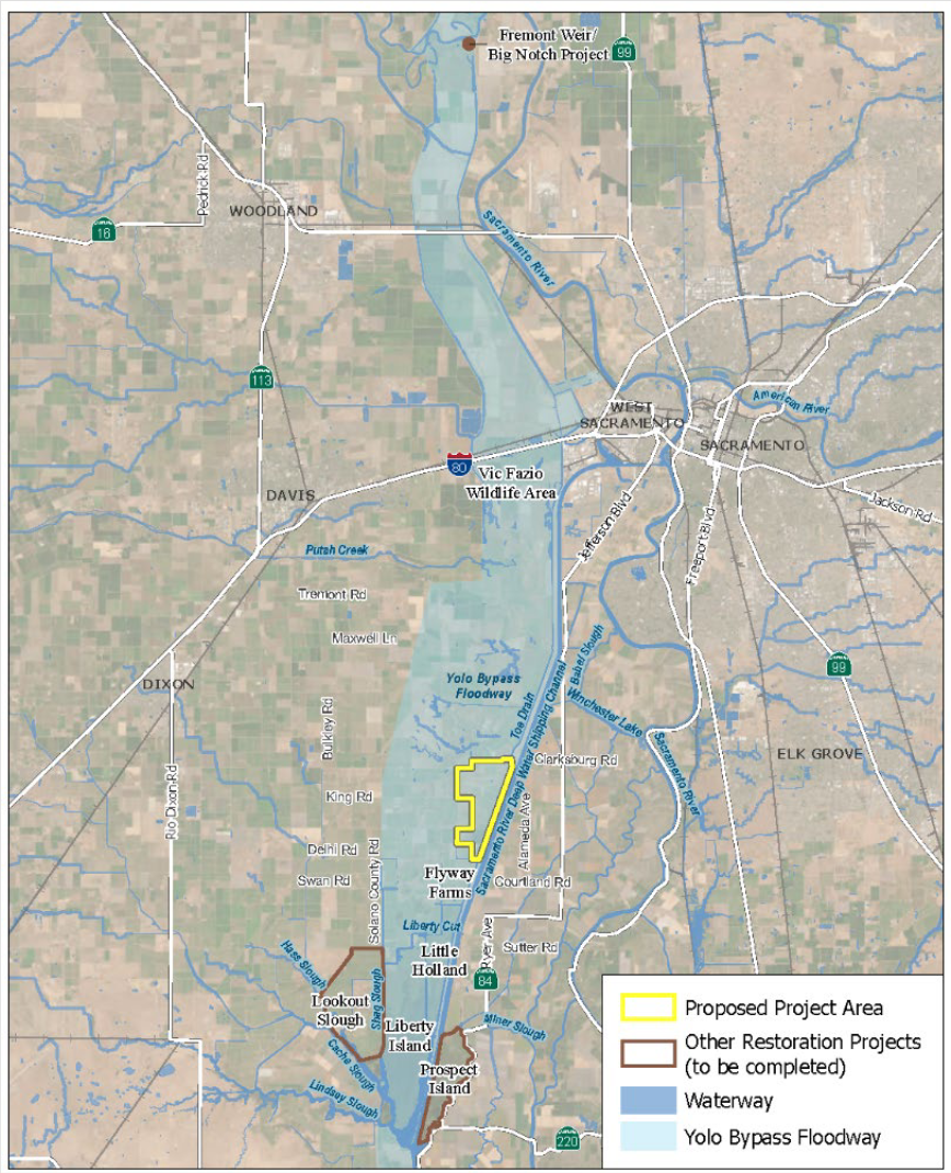
The proposed 2,212-acre Tide’s End multi-benefit restoration project is in Yolo County at the downstream end of the Yolo Bypass, about 12 miles southwest of Sacramento. Adjacent to the Cache Slough Complex and the Toe Drain along the west side of the Sacramento Deep Water Ship Channel, the site lies where the Yolo Bypass floodplain meets the Delta’s tidal influence, giving the project its name and contributing to its ecological importance.
Current land uses include agriculture, upland habitat used for pheasant hunting, and managed waterfowl habitat. The project would restore tidal wetland habitat, support floodplain agriculture, and improve conveyance through the Yolo Bypass.
If constructed, the Tide’s End project would fill a key gap and complete a continuous 10-mile wetland habitat corridor from the southern tip of the recently completed Lookout Slough Project to the Yolo Bypass Wildlife Area. The project would build on nearby tidal restoration efforts that have expanded habitat connectivity and nutrient exchange to support aquatic food webs.
Ecosystem Investment Partners (EIP) currently owns the project area. If the project is permitted and proceeds, EIP intends to transfer ownership to the Department of Water Resources.
Project Goals
The project’s primary goal is to restore tidal and floodplain habitat in the Yolo Bypass for native fish and wildlife. Proposed improvements would increase aquatic food-web production, allow juvenile salmon and other native fish to move voluntarily onto the floodplain during high-flow events, improve drainage, and reduce the risk of fish stranding after floods. The restored site would also support flood conveyance and long-term resilience to climate change and sea-level rise.
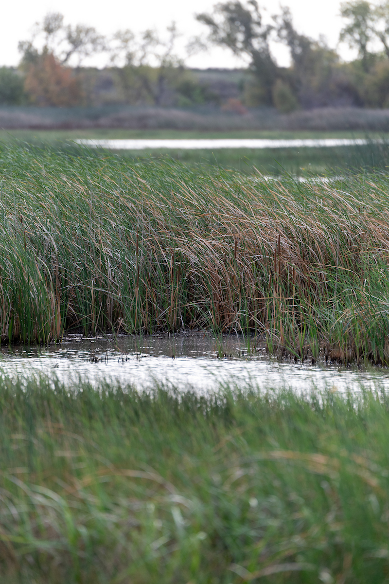
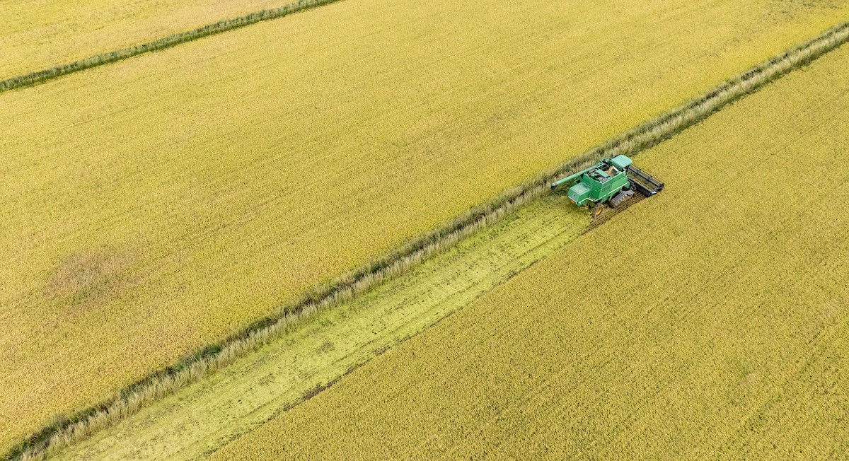
A second goal is to maintain land uses compatible with habitat restoration, including flood-compatible agriculture such as wild rice production and managed seasonal wetlands for waterfowl. A third goal is to reduce flood risk while supporting habitat objectives.
Although habitat restoration remains the project’s central purpose, the design treats flood management, recreation, and agriculture as integral, compatible uses rather than secondary considerations.
“While this is fundamentally a restoration project, it is integrated with other compatible land uses and flood conveyance, which is directly related to water supply reliability,” said Judah Grossman. “This is a true multi-benefit project.”
Project Design
The project design combines tidal habitat restoration with floodway-compatible agriculture, including wild rice production, and managed seasonal wetlands for waterfowl. Irrigation and drainage improvements would support these land uses while providing broader benefits to the surrounding area.
Tidal inundation would be restored by opening or lowering selected berms and excavating channels. The resulting habitat would support plankton production and allow juvenile salmon and other native fish to access the floodplain during high-flow events.
The design has four main components:
- Open or lower selected Toe Drain berms to improve tidal connectivity and drainage between the Toe Drain and the project area.
- Excavate tidal and drainage channels.
- Install fish-passable water-control structures.
- Improve irrigation, drainage, access, and supporting utilities to simplify water management and increase efficiency within the project area and the surrounding community.
The slide below compares existing conditions on the left with the proposed design on the right. In place of the relatively uniform habitat shown under current conditions, the project would create a network of tidal channels and a mosaic of habitat types while retaining compatible uses, including managed wetlands and agriculture, shown in peach.
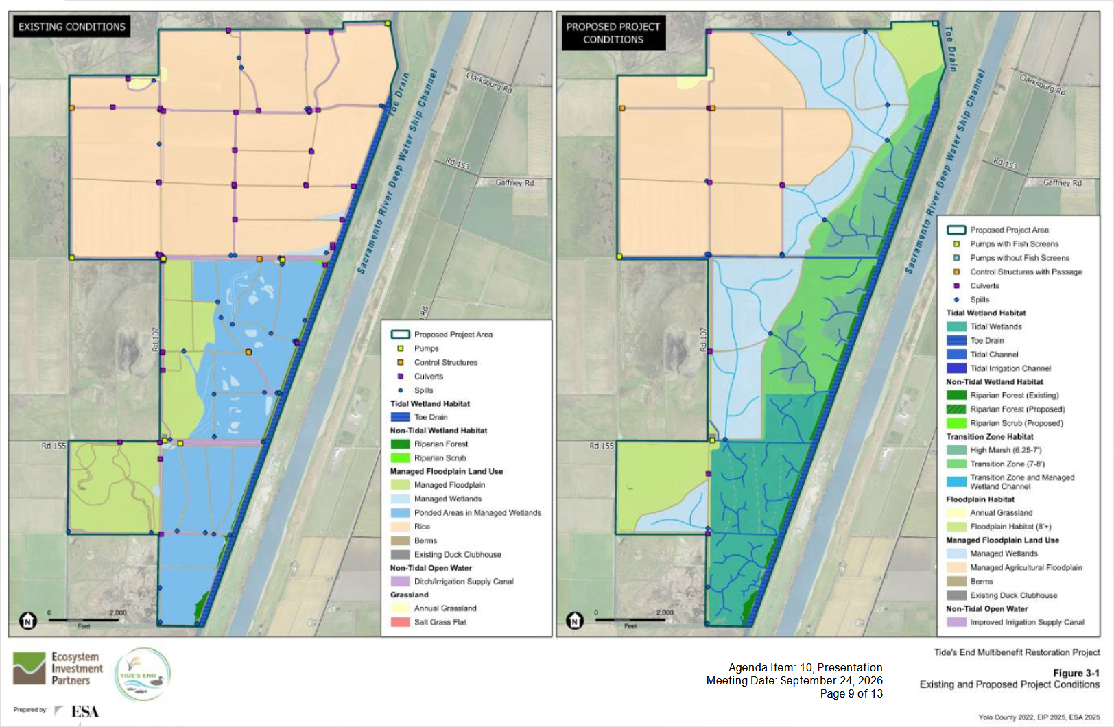
Mr. Grossman also noted that the proposed design would use fewer water-control structures and culverts than the existing system, reducing constrictions and simplifying water management.
How the project connects to the Delta Plan and other planning processes
The project supports the Delta Plan’s coequal goals and its emphasis on the Delta as an evolving place. Proposed habitat improvements would enhance fish passage, aquatic food-web production, and wildlife habitat. Continued agriculture and managed wetlands for waterfowl would preserve compatible land uses, while drainage improvements could benefit neighboring properties. The project’s flood-conveyance features would also support water supply reliability.
The project also advances the goals of the Central Valley Flood Protection Plan (CVFPP) and its Conservation Strategy. It would maintain long-term flood capacity by managing floodway roughness, or resistance to water flow, and limiting potential encroachments in the Yolo Bypass. It would also increase the extent, quality, and connectivity of aquatic, wetland, and riparian habitat within the flood system.
Tide’s End is identified in the Healthy Rivers and Landscapes Program (HRL), a proposed implementation pathway in the draft update to the Bay-Delta Water Quality Control Plan under consideration by the State Water Resources Control Board. The program recognizes Tide’s End as contributing to Delta habitat goals. However, the project is not dependent on HRL and would proceed regardless of whether the Water Board adopts the program.
Permitting
Tide’s End is using the Statewide Restoration General Order (SRGO) as its primary permitting pathway for state water-quality requirements. Issued by the State Water Resources Control Board in 2022 as Order WQ 2022-0048-DWQ, the SRGO provides Clean Water Act Section 401 water-quality certification, waste discharge requirements, and program-level CEQA coverage for habitat restoration projects that meet its eligibility criteria.
DWR, the lead agency under the California Environmental Quality Act (CEQA), prepared the project’s environmental review through the SRGO authorization process and released a Draft Supplemental Environmental Impact Report (Draft SEIR) in February 2026. According to DWR, Tide’s End qualifies because it would restore and enhance several aquatic habitat types, produce a net increase in tidal wetland and associated floodplain functions, and provide flood-management benefits.
Other anticipated approvals include a regional general permit from the U.S. Army Corps of Engineers for Clean Water Act Section 404 coverage and a restoration management permit from the California Department of Fish and Wildlife that would address incidental take and lake or streambed alteration requirements. The project team also plans to rely on existing programmatic biological opinions administered by the U.S. Fish and Wildlife Service and NOAA Fisheries for compliance with the federal Endangered Species Act.
“This is our intended permit pathway,” said Mr. Grossman. “This doesn’t mean that the permits are secured. It’s a long path to get there, but this is our intended approach.”
Timeline
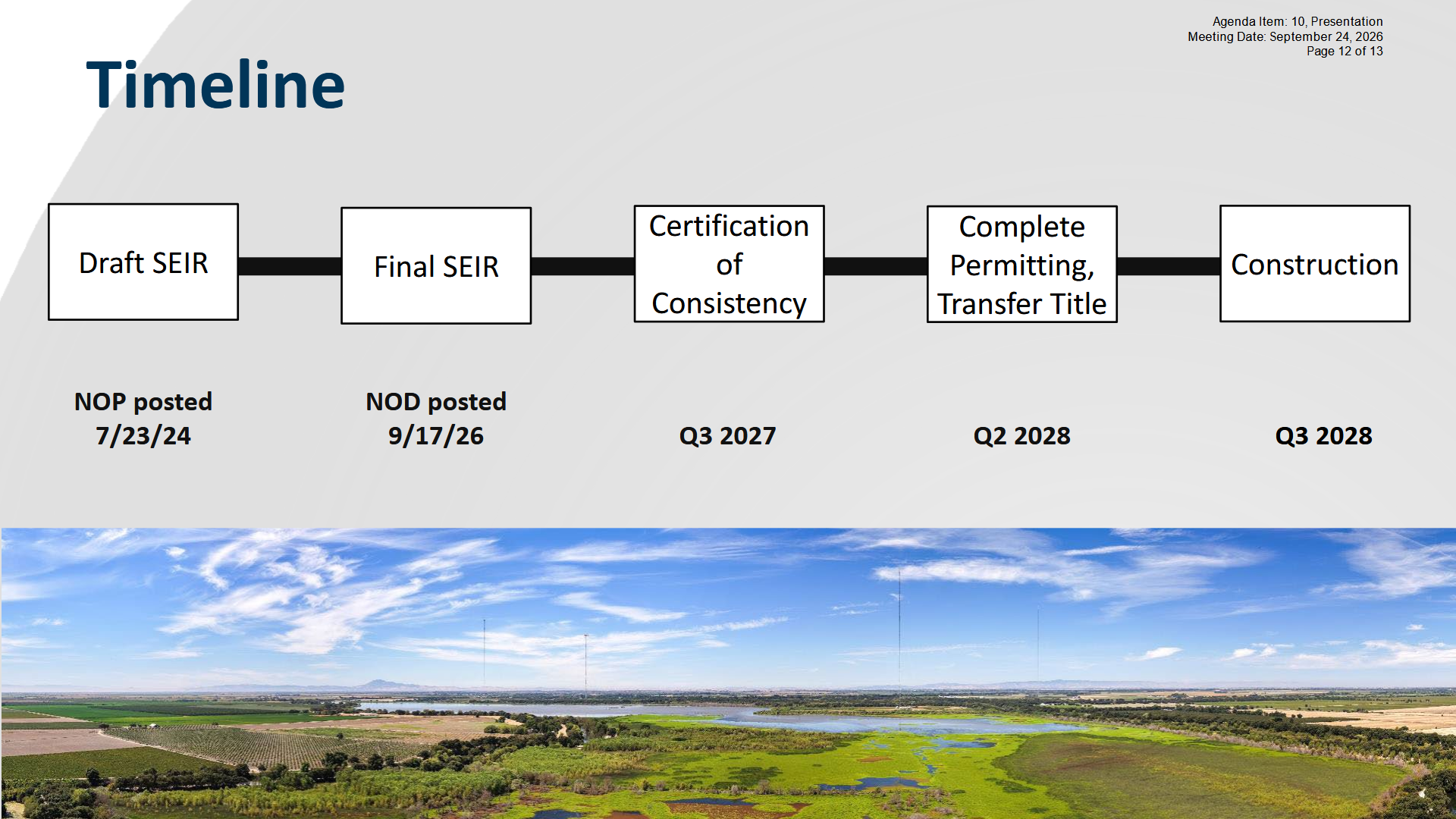
The project timeline identifies both completed and anticipated milestones. DWR completed the CEQA environmental review by filing a Notice of Determination and issuing the final SEIR on September 17. The project team plans to submit a certification of consistency with the Delta Plan in the third quarter of 2027, secure project permits by the second quarter of 2028, and begin construction in the third quarter of 2028.
“With any land-use change, there are many factors, constituents, and groups to coordinate with,” said Mr. Grossman. “The diversity of the design directly reflects what we have learned over time from other projects, and we have tried to address those considerations as much as possible. Some of the proposed drainage improvements are meant to benefit neighboring properties and the broader community as well. There have been concerns along the way, and we have tried to address them and be responsive as they have arisen.”